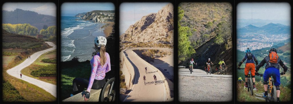
Spain is one of Europe’s most diverse and rewarding countries for cycling, with a range of coastal greenways, mountain passes, long historic pilgrimage paths, and islands waiting to be explored on two wheels.
It’s perfect for everything from challenging cross-country multi-day tours to short, relaxing scenic rides for the most casual of cyclists.
Here are some of the best cycling routes in Spain with practical info to plan your ride.
Short Cycle Routes
Valencia → Albufera Natural Park
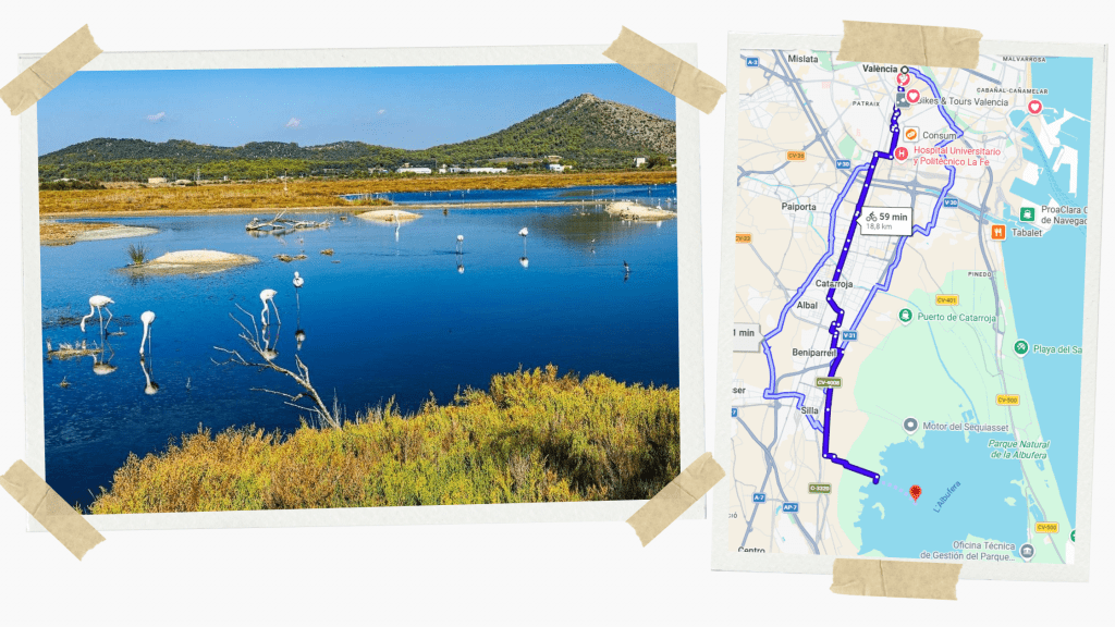
One of Spain’s most relaxed and accessible urban-to-nature rides. You leave Valencia via bike lanes and rural paths and quickly find yourself among rice fields, canals, and lagoons.
Route Overview
Distance: 19-22 km (16 miles) one way
Terrain: Flat
Difficulty: Easy
Best season: Year-round (best spring and autumn)
Notes
- Takes around an hour one way
- Perfect for beginners or casual riders
- Ideal for sunset cycling
- Combine with a paella stop in El Palmar
Santander → Santillana del Mar
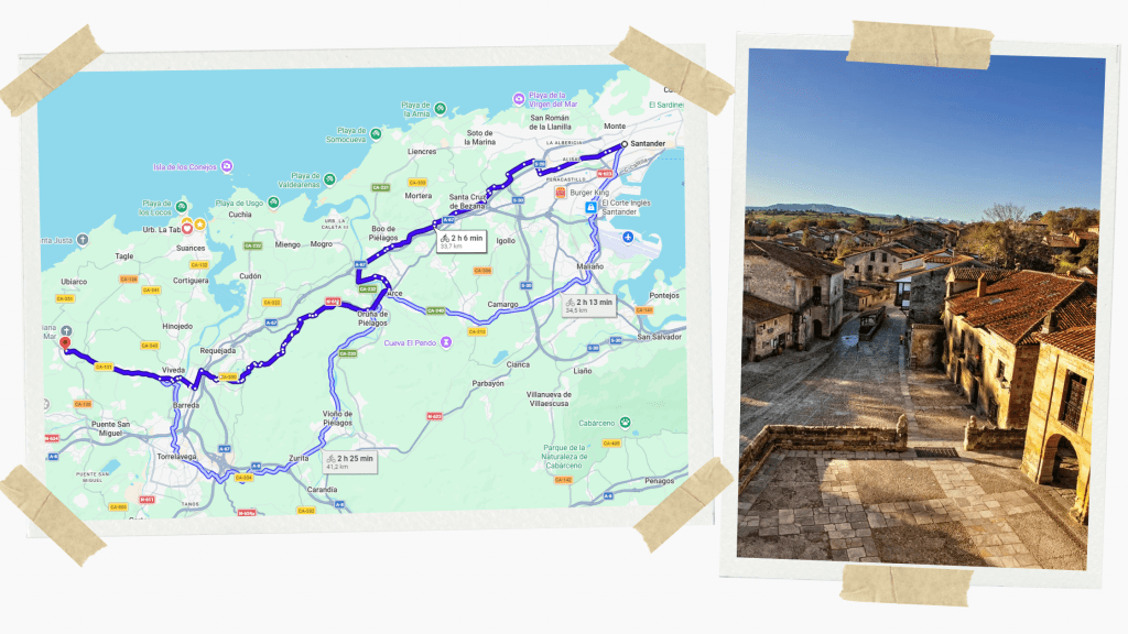
A classic Cantabrian countryside ride linking a coastal capital to one of Spain’s prettiest medieval villages.
Expect green fields, stone houses, and beautiful cobbled streets when you dismount on arrival.
Route Overview
Distance: 30-35 km (18-20 miles) one way
Terrain: Gently rolling
Difficulty: Easy-Moderate
Best season: May-September
Notes
- Ideal half-day ride taking roughly 2-2.5 hours, depending on stops
- Great for road or gravel bikes
- Pair with a café stop and slow return
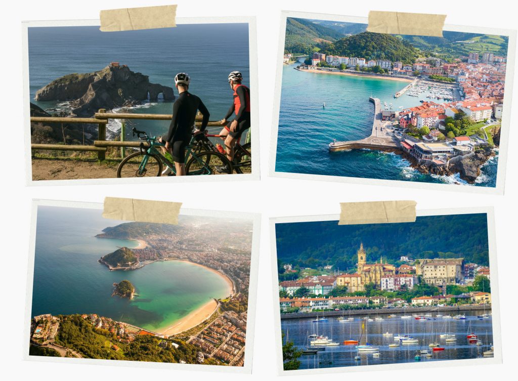
Bilbao → San Juan de Gaztelugatxe
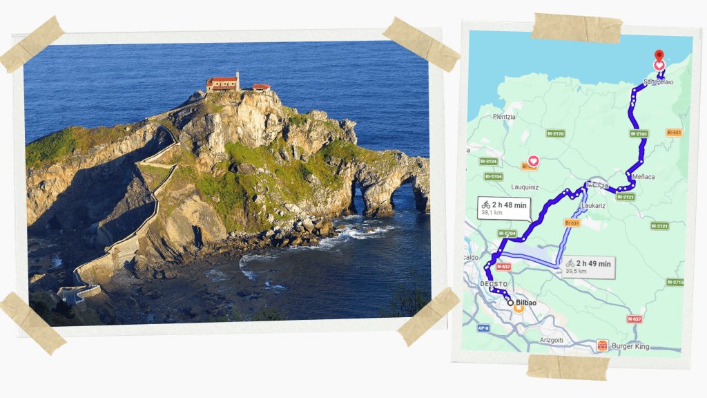
This is one of the most visually rewarding short rides in northern Spain.
Leaving Bilbao, you gradually transition from urban bike paths to quiet coastal roads, with constant Atlantic views once you approach the coast.
The final approach includes climbing and narrow roads, and the bike must be left before walking the iconic stairway to the chapel.
Route Overview
Distance: 38-40 km (24 miles) one way
Terrain: Rolling with short but punchy climbs
Difficulty: Moderate
Best season: April-June, September-October
Notes
- 2.5-3.5 hours of riding, depending on stops
- Bring lights if returning the same day
- Wind can be a factor near the coast
Sevilla → Carmona
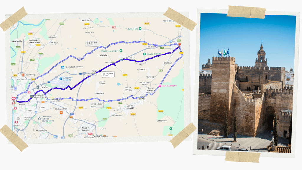
This ride follows historic routes across open Andalucían countryside toward Carmona, dramatically perched above the plains.
There’s very little shade, but the sense of scale and history is huge.
Route Overview
Distance: 37-40 km (22 miles) one way
Terrain: Rolling, exposed
Difficulty: Moderate (heat-dependent)
Best season: October-April
Notes
- 2-2.5 hours of riding, depending on stops
- Start early to avoid the heat
- Carry more water than you think you need
- Carmona’s elevation means tough final climb
Madrid → Chinchón
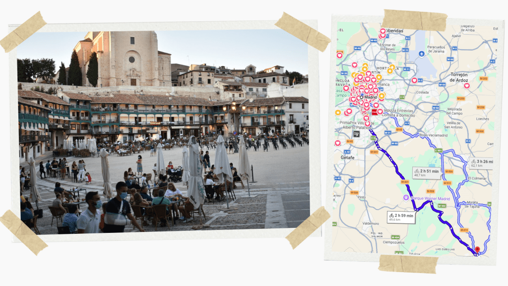
Route Overview
Distance: 48-50 km (30 miles) one way
Terrain: Rolling with a final climb
Difficulty: Moderate
Best season: Spring & autumn
Notes
- Allow extra time for the final ascent
- Worth staying for lunch
- Best avoided in peak summer heat
Madrid → Alcalá de Henares
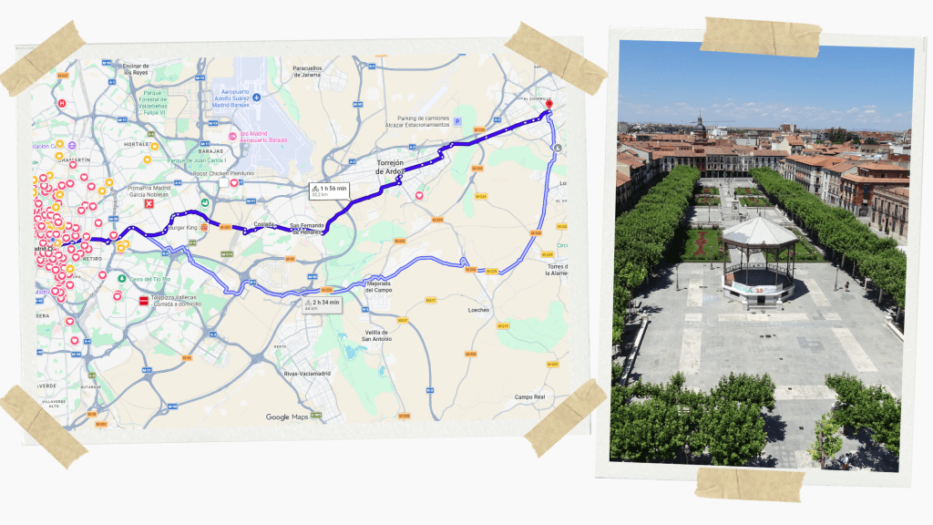
A very popular ride following river corridors and quiet roads. Alcalá’s UNESCO-listed historic centre makes this a rewarding cultural finish.
Route Overview
Distance: 35 km (22 mi) one way
Terrain: Flat to gently rolling
Difficulty: Easy-Moderate
Best season: March-June, September-November
Notes
- Comfortable ride taking around 2 hours
- Easy train return
- Be careful of traffic near Madrid exits
Madrid → Aranjuez
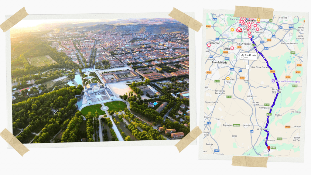
A classic Spanish cycle day trip, this ride follows gentle river corridors out of the city and into open countryside, using flat, well-paced terrain tracing the water’s edge for long stretches.
The landscape shifts from urban edges to expansive royal hunting grounds and cultivated gardens with a ceremonial feel as you approach the royal city of Aranjuez.
It is the ideal day ride: long enough to feel earned, flat enough to enjoy, and rich enough to remember.
Route Overview
Distance: 50-52 km (31 miles) one way
Terrain: Mostly flat
Difficulty: Moderate (distance-based)
Best season: March-May, September-October
Notes
- 3-4 hours riding time
- Easy train return
- Ideal for steady endurance pacing
Girona → Cadaqués
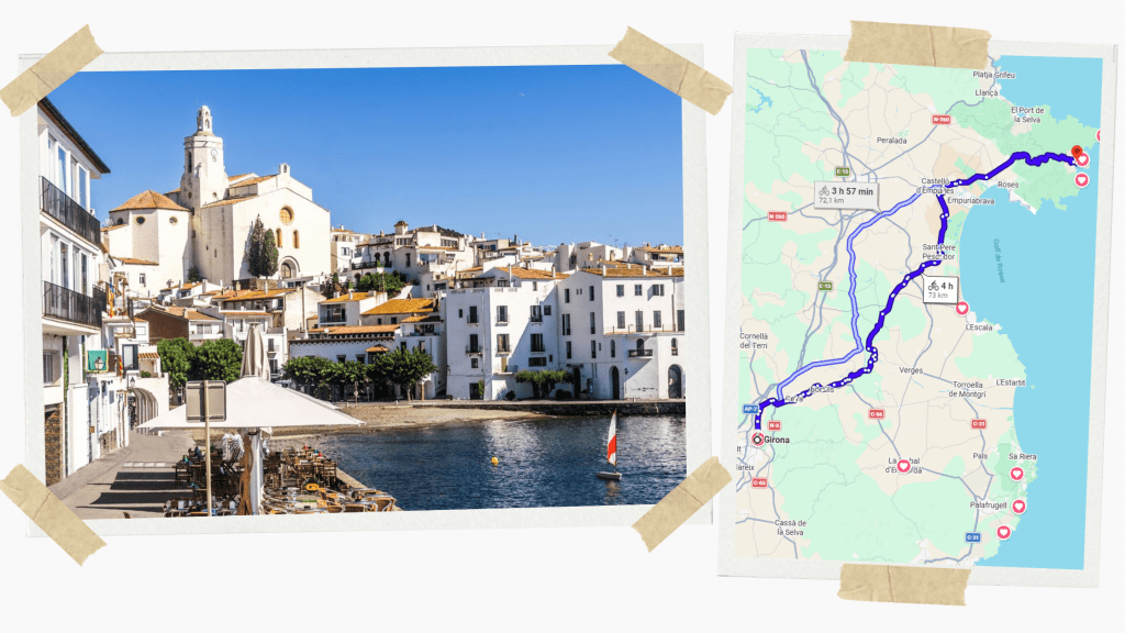
This is one of Spain’s most beautiful single-day rides. Leaving Girona, you climb steadily through inland Catalonia before cresting the final ridges and dropping dramatically toward the Mediterranean.
The approach to Cadaqués is spectacular with winding roads, sea views, and a whitewashed village finish.
Route Overview
Distance: 72-74 km (45 miles)
Terrain: Mountainous → coastal descents
Difficulty: Hard
Best season: April-June, September-October
Notes
- 5-6 hours riding time
- Strong climbing legs required
- Plan food stops early, as services thin out late
- Ideal for experienced road cyclists
2-Day Cycle Routes
Barcelona → Tarragona
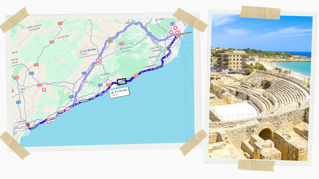
This is a full endurance day rather than a casual outing. It can also be split into two days with a stop at Sitges.
The reward is a finish among Roman ruins overlooking the Mediterranean. Wind can play a big role, especially south of Sitges.
Route Overview
Distance: 116 km ( miles) one way
Terrain: Mostly flat with rolling coastal sections
Difficulty: Moderate-Hard
Best season: March-June, September-October
Route Plans
Option 1
Two-day split (Recommended)
Day 1 – Barcelona → Sitges (47 km/29 m)
Day 2 – Sitges → Tarragona (57 km/25 m)
Riding time: Day 1 – 2.5-3.5 hrs, Day 2 – 3-3.5 hrs
Who it’s for: Riders looking to move at a good pace, but not too difficult
Option 2
Straight Barcelona to Tarragona (116 km/72 m)
Riding time: 6.5-7 hours
Who it’s for: Strong endurance riders comfortable with long days
Notes
- Plan 6-7 hours riding time
- Train or return by train
- Early start recommended
Granada → Cabo de Gata
Via Calahorra
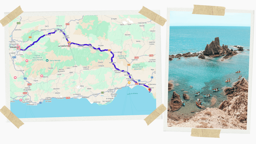
This ride takes you from the foothills of the Sierra Nevada to one of Spain’s most striking and untamed coastlines. You pass through dry landscapes and wide open terrain before gradually descending toward Almería’s volcanic shores.
The final approach to Cabo de Gata is unforgettable, with black volcanic rock, empty roads, turquoise coves, and an almost desert-like stillness.
Because of the distance and exposure, this should be a two-day ride, with a strategic overnight stop in Calahorra to see El Castillo de la Calahorra and then arrive at the coast rested and ready to explore.
Route Overview
Distance: 190 km (118 miles)
Terrain: Rolling inland plains → arid hills → coastal descents
Difficulty: Hard
Best season: March-May, late September-October (summer heat is severe)
Route Plan
Day 1: Granada → Castillo de la Calahorra → Calahorra (72 km/45 m)
Day 2: Calahorra → Cabo de Gata (118 km/70 m)
Riding time: Day 1 – 4.5-5.5 hrs, Day 2 – 5.5/6.5 hrs
Notes
- Heat and sun exposure are the main challenges
- Carry more water than usual as services are sparse
- Wind can be decisive near the coast
- Endurance or gravel bike with wider tyres recommended
Santander → Bilbao
Via Castro-Urdiales
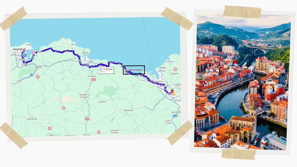
This ride, linking two great Spanish cities along the north coast, can be done in one ambitious day or with a convenient stop at Castro-Urdiales, a compact, atmospheric old harbour town with excellent food and accommodation.
You’ll roll out of Santander early, settle into a rhythm, and spend most of the day threading coastal towns and headlands before finishing in Bilbao.
It combines cliffs, beaches, fishing towns, and constant elevation change. It’s never brutally mountainous, but it is relentless: short climbs, exposed headlands, wind, and a steady accumulation of fatigue. Scenic but demanding.
Route Overview
Total Distance: 125-130 km (78–80 miles), depending on routing
Terrain: Rolling coastal roads, frequent short climbs
Difficulty: Moderate-Hard
Best season: May-September (weather & day length)
Best bike: 30–32 mm tyres recommended
Route Plans
Option 1
Two-day split (Recommended)
Day 1 – Santander → Castro-Urdiales (80 km/50 m)
Day 2 – Castro-Urdiales → Bilbao (40 km/25 m)
Riding time: Day 1 – 5/5.5 hrs, Day 2 – 2.5/3 hrs
Who it’s for: Riders looking to move at a good pace, but not too difficult
Option 2
Straight Santander to Bilbao (130 km/80 m)
Riding time: 7.5-9 hours
Who it’s for: Strong endurance riders comfortable with long coastal days
Important Notes
- Start early to beat traffic and wind
- Wind direction can make or break the day
- Northern Spain’s weather can change quickly
- Expect short, sharp climbs
- Plenty of services, but plan food stops
- Traffic increases near Bilbao
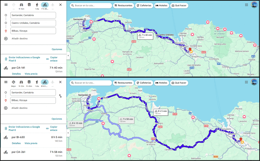
You can load the map above on Google Maps here, though I recommend downloading Komoot and loading each stage through that.
Multi-Day Cycle Routes
Santander → Hondarribia / Hendaye
Via Castro-Urdiales, Bilbao, San Juan de Gaztelugatxe, Lekeitio, San Sebastián
Distance: 300 km (186 miles)
Terrain: Constant rolling hills
Difficulty: Hard / Multi-day
Best season: May-September
Route Plans
Stage 1: Santander → Castro-Urdiales = 80 km / 50 miles (5-5.5 hrs)
Stage 2: Castro-Urdiales → Bilbao = 40 km / 25 miles (3 hrs)
Stage 3: Bilbao → San Juan de Gaztelugatxe → Mundaka = 52 km / 32 miles (4hrs)
Potential rest day in the surf town of Mundaka
Stage 4: Mundaka → Lekeitio → Zumaia = 67 km / 41 miles (4-4.5 hrs)
Stage 5: Zumaia → Getaria → Zarautz → San Sebastián = 36 km / 22 miles (2.5 hrs)
Stage 6: San Sebastián → Hondarribia → Hendaye = 29 km / 18 miles (2 hrs)
*The last stop Hendaye is across the border in France
Important Notes
- Best split into 4-6 days
- The later days allow stops to enjoy coastal towns
- Expect humidity and rain
- Compact gearing recommended
- Food culture alone justifies the effort
- Worth spending a day in San Sebastián if it’s your first time
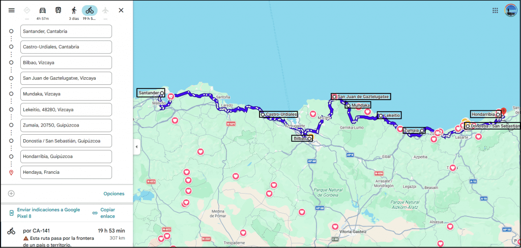
You can load this route on Google Maps here.
Barcelona → Valencia
Via Sitges, Tarragona, La Ametlla de Mar, Peñíscola, Castellón de la Plana
Distance: 386 km (240 miles)
Terrain: Mostly flat with rolling coastal stretches
Difficulty: Moderate-Hard
Best season: March-June, September-October
Route Plan
Stage 1: Barcelona → Sitges =47 km/29 m (2.5-3.5 hrs)
Stage 2: Sitges → Tarragona = 57 km/25 m (3-3.5 hrs)
*Or straight Barcelona to Tarragona (116 km/72 m)
Stage 3: Tarragona → La Ametlla de Mar = 57 km/35m (3-3.5 hrs)
Stage 4: La Ametlla de Mar → Peñíscola = 83 km/51 m (4.5-5 hrs)
Stage 5: Peñíscola → Castellón de la Plana = 70 km/43 m (3.5-4.5 hrs)
Stage 6: Castellón de la Plana → Valencia = 72 km/44 m (3.5-4.5 hrs)
Notes
- 4-7 days recommended
- Train access allows flexible stages
- Strong sun exposure, sunscreen essential
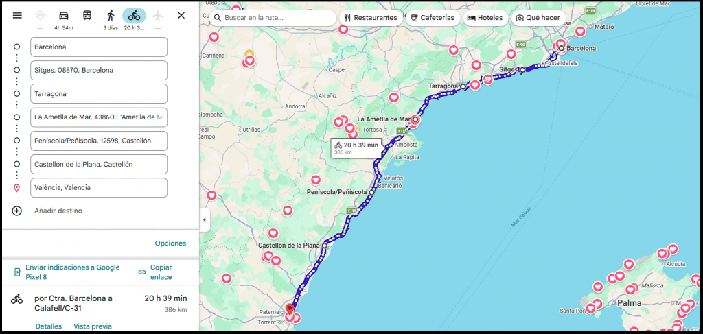
You can load this route on Google Maps here.
Cross-Country Cycle Routes
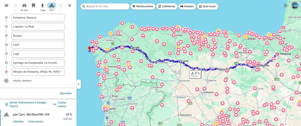
Pamplona → Faro de Fisterra
Via Logroño, Burgos, Palencia, León, Ponferrada, Lugo and Santiago de Compostela
To go from Pamplona to Faro de Fisterra by bike, you follow the ancient pilgrimage path, Camino Francés (The French Way), the most famous and historically significant of all the Camino de Santiago routes.
For cyclists, this route is both iconic and demanding. Starting in Pamplona (or another of the cities in north-east Spain), it cuts west across the north of the Iberian Peninsula through Navarra, La Rioja, Castile, León and finally into the misty hills of Galicia.
After reaching Santiago de Compostela, the route continues onward to Faro de Fisterra, long considered the “end of the world,” ending where land gives way to the Atlantic Ocean at the westernmost point of continental Europe.
You feel the landscape and the culture change under your wheels as you transition through Navarra, La Rioja, Castile, León, and into Galicia’s misty hills.
It’s more social and structured than many long-distance routes, but still immense in scale, making it both physically tough and mentally absorbing. A classic for experienced cyclists who want history, challenge, and a powerful sense of arrival.
Route Overview
Start / End: Pamplona → Faro de Fisterra
Total Distance: ~870 km (540 mi)
Typical Duration: 14-20 days
Terrain: Rolling hills → long plains → mountain passes → Galician hills
Difficulty: Hard (endurance & cumulative fatigue)
Best season: April-June and September-October. Summer is hot and crowded.
Best bike: Endurance road or gravel bike (30–35 mm tyres recommended)
Route Split
Stage 1: Pamplona → Logroño = 96 km (5 hr – 5.5 hr)
Stage 2: Logroño → Burgos = 128 km (7 hr – 7.5 hr)
Potential rest day (Burgos)
Stage 3: Burgos → Palencia = 90 km (5 hr – 5.5 hr)
Stage 4: Palencia → León = 126 km (6 hr – 6.5 hr)
Potential rest day (León)
Stage 5: León → Ponferrada = 100 km (6hr – 6.5hr)
Stage 6: Ponferrada → Lugo = 135 km (8 hr)
Potential rest day (Lugo)
Stage 7: Lugo → Santiago de Compostela = 112 km (7 hr)
Stage 8: Santiago de Compostela → Faro de Fisterra = 82 km (5 hr)
Route Pacing
Relaxed touring: 45–55 km/day across 18–20 days
Moderate endurance: 60–70 km/day across 14–16 days
Strong endurance: 75–90 km/day across 11–13 days
Most cyclists benefit from at least two rest days, especially before and after the León-Galicia transition.
Important Notes
- The Camino Francés is busy, so expect walkers, especially in summer
- Navigation apps are useful even with good signage
- Accommodation is abundant but fills quickly in peak season
- Some sections are rougher; tyre clearance matters
- Galicia is hilly and slower than distances suggest
- Finishing at Fisterra is extra special, don’t skip it
Sevilla → Gijón
Via Monasterio, Mérida, Cáceres, Salamanca, Zamora and León
To go from Sevilla to Gijón by bike, you take the Vía de la Plata, a long-distance route that traces an ancient Roman north-south axis from Andalucía to the Cantabrian Sea.
For cyclists, it offers something rare: a true cross-section of Spain, moving from olive groves and Roman ruins through wide interior plains, historic cities, and finally into the green mountains of Asturias.
It’s quiet, ancient, and immense. You feel the geography change under your wheels, culturally, linguistically, climatically. Finishing in Gijón, dipping into the Atlantic after crossing an entire country by bike, feels earned in the deepest sense.
It’s less touristy than coastal routes, more introspective, and immensely rewarding.
Route Overview
Start / End: Sevilla → Gijón
Total Distance: ~850-900 km (525-560 mi), depending on variants
Typical Duration: 12-18 days
Terrain: Flat plains → rolling countryside → sustained northern climbs
Difficulty: Hard (endurance & logistics)
Best season: March-May and September-October. Summer is brutal.
Best bike: Endurance road bike (with 30-32 mm tyres)
Route Split
Stage 1: Sevilla → Monasterio = 100 km (6 – 6.5 hr)
Stage 2: Monasterio → Zafra = 45 km (2.5 – 3 hr)
Stage 3: Zafra → Mérida = 65 km (3 – 3.5 hr)
Stage 4: Mérida→ Cáceres = 76 km (4 – 4.5 hr)
Potential rest day (Cáceres)
Stage 5: Cáceres → Plasencia = 95 km (5 – 5.5 hr)
Stage 6: Plasencia → Béjar = 67 km (4 – 4.5 hr)
Stage 7: Béjar → Salamanca = 75 km (4 – 4.5 hr)
Potential rest day (Salamanca)
Stage 8: Salamanca → Zamora = 70 km (3.5 – 4 hr)
Stage 9: Zamora → Benavente = 62 km (3 – 3.5 hr)
Stage 10: Benavente → León = 75 km (4 hr – 4.5 hr)
Potential rest day (León)
Stage 11: León → Pola de Lena = 90 km (5 hr – 5.5 hr)
Stage 12: Pola de Lena → Gijón = 58 km (3.5 -4 hr)
Route pacing
Relaxed touring: 45-55 km/day across 16-18 days
Moderate endurance: 60-70 km/day across 13-15 days
Strong endurance: 75-90 km/day across 10-12 days
Important notes
- Early starts are essential to counter heat and exposure
- Navigation apps are essential, as signage is inconsistent
- Accommodation is pilgrim-friendly but more spaced out than on the Camino Francés
- Train connections exist at major cities if you need to shorten stages
- Carry more water capacity than usual (especially south of Salamanca)
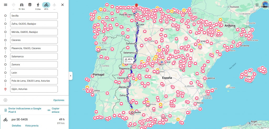
You can load the map above on Google Maps here, though I recommend downloading Komoot and loading each stage through that.
Mallorca Routes
Mallorca is widely regarded as Spain’s premier road-cycling destination. The island offers immaculate tarmac, abundant cycling cafés, and terrain that ranges from pancake-flat coastal roads to leg-breaking alpine-style climbs in the Serra de Tramuntana.
It’s used every spring by WorldTour teams, yet remains accessible for amateurs thanks to excellent infrastructure and flexible route options.
Palma → Port de Pollença
This is Mallorca’s classic point-to-point ride and a favourite among visiting cyclists. Leaving Palma, you cruise along flatter inland or coastal roads before the terrain begins to rise as you approach the Tramuntana foothills.
The ride finishes in Port de Pollença, a cycling hub with cafés, bike hotels, and access to iconic climbs.
Route Overview
Distance: 90-105 km (56-65 mi), depending on routing
Terrain: Flat → rolling → sustained climbs
Difficulty: Moderate-Hard
Best season: March-June, September-November
Route Highlights
- Palma → Inca or Sa Pobla (fast, flat warm-up)
- Gradual climbs toward Lluc or coastal roads
- Optional extension to Cap de Formentor
Notes
- 4.5–6.5 hours riding time
- Ideal for a strong endurance day
- Easy logistics: luggage transfers and buses available
- Excellent café stops throughout
Full Island Loop
The full loop is a proper bike-touring challenge, usually split into 4-7 days.
You’ll experience nearly every cycling environment Mallorca has to offer: salt flats, quiet agricultural roads, cliff-hugging coastlines, and legendary mountain passes.
Route Overview
Distance: ~250–320 km (155-200 mi), depending on coastal vs inland choices
Terrain: Flat plains + repeated mountain stages
Difficulty: Hard (multi-day)
Best season: Spring & autumn (summer heat is punishing)
Key Climbing Zones
Serra de Tramuntana (UNESCO-listed)
- Puig Major area
- Sa Calobra (optional but iconic)
Important Notes
- Average 50–80 km per day is ideal
- Compact gearing is strongly recommended
- Winds can be decisive on the east and south coasts